Following our earlier update on subsurface temperature measurements, we are pleased to share new insights from the Geo4all research programme.
Temperature is a key parameter in determining geothermal potential: a difference of just 1 °C in reservoir temperature can result in tens of gigawatt-hours of additional heat production over the lifetime of a project.
Why are some formations warmer than others?
Analyses show that production temperatures in the Slochteren Formation are higher than in the Delft Sandstone Formation, despite comparable depths. This is due to differences in the thermal properties of the rocks:
-
In well-conductive salt layers, such as Zechstein salt, the temperature gradient is lower.
-
In formations with low thermal conductivity, such as the Cretaceous, the gradient can reach up to 40 °C/km.
-
Differences in porosity, internal heat generation from natural radioactive decay, and local heat flow also play a role.
These variations explain why some subsurface layers are significantly warmer than others, and why temperature differences occur between regions. The ThermoGIS model developed by TNO maps regional temperature variations, but the accuracy of this model strongly depends on the quality and availability of temperature measurements.
The importance of accurate measurements
Reliable temperature data are crucial for ThermoGIS and for estimating geothermal potential. Standard temperature logs taken shortly after drilling often contain distortions caused by the drilling process and therefore give an inaccurate picture. In addition, the relatively high logging speed (10–100 m/min) means that the temperature sensors cannot respond quickly enough, resulting in smoothed and generally underestimated temperature profiles.
More reliable data can be obtained using dedicated temperature logs or permanently installed downhole sensors, which are:
-
recorded at lower logging speeds (3–5 m/min), and
-
equipped with more accurate and faster sensors (deviation <0.5 °C).
Furthermore, Distributed Temperature Sensing (DTS) offers new opportunities for continuous, high-resolution monitoring.
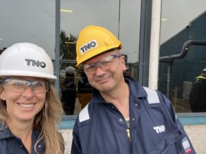
New field measurements
Recently, temperature logging was carried out at Gaia Energy, a Geo4all partner, with support from Well Services Group. Temperature measurements have also been performed by project partner Ennatuurlijk Aardwarmte. These new datasets provide valuable information to improve our understanding of temperature gradients and geothermal cooling.
More results and analyses will follow in the coming weeks – stay tuned!
- For more information about the models, visit www.thermogis.nl
- See also the earlier post: Geo4all investigates underground temperatures: new insights on the way